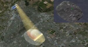
NISAR satellite sends first detailed radar images of Earth’s surface
New, highly detailed images of Earth’s surface provide unique, actionable information to decision-makers in a diverse range of areas, including disaster response, infrastructure monitoring, and agricultural management
Copy and paste this URL into your WordPress site to embed
Copy and paste this code into your site to embed